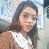
Kalpana Pardeshi

Faculty

Assistant Professor, Architecture Department
Email: kpardeshi@mes.ac.in

Education
  • M.Sc.
    2014: Pune University in Geoinformatics
  • M.A.
    2012: Pune University in Geography (Specialization- Geomorphology)
  • B.A.
    2010: Pune University in Geography
Research and Consultancy
  • Application of GIS and Remote Sensing in Urban Planning and Environmental Management: Leveraging spatial data to drive sustainable urban development, optimize resources, and enhance environmental conservation efforts.
  • Spatial Data Analysis and Machine Learning for Urban Resilience: Utilizing advanced geospatial techniques and machine learning algorithms to address urban challenges, promote resilience, and inform policy decisions in cities.
  • Geospatial Techniques for Disaster Management and Climate Adaptation: Implementing cutting-edge geospatial tools to enhance disaster preparedness, climate adaptation strategies, and improve environmental management practices.
  • Collaboration with NYU Stern and Urban Expansion Observatory: Engaged in interdisciplinary research projects aimed at achieving Sustainable Development Goals (SDGs), focusing on urban growth patterns, sustainability, and resilience.
Research Projects
  • Monitoring Land Subdivision and Irregular Settlement Formation in Sub-Saharan Africa: Developing machine learning-based datasets to analyze settlement types across SSA cities.
  • City Transport Indicator Study: 20 Macro Urban Areas: Analyzing urban transport indicators to enhance mobility, infrastructure, and urban accessibility.
  • Urban Shift Project: Supporting cities with research and consultancy for sustainable urban development, ecosystem enhancement, and improved urban quality of life.
  • Accommodating Urban Growth in the Latin American and Caribbean Region: Collaborating with IADB to manage sustainable urban expansion in this region.
  • UK PACT Project: Working on capacity building, policy development, and climate action strategies for carbon emission reduction and sustainable development.
  • C-40 Project: Providing research and consultancy services for global cities to implement climate action plans focusing on reducing greenhouse gas emissions and enhancing resilience.
  • Mapping Informal Settlements in Lusaka, Zambia: Using remote sensing technologies for mapping informal settlements, contributing to policy decisions and improving living conditions.
  • Atlas of Urban Expansion Website: Analyzing global urban growth patterns to provide data-driven insights for urbanization management.
  • 100 Resilient Cities Initiative: Assisting cities in becoming more resilient to physical, social, and economic challenges through research and consultancy.
  • Monitoring Global Expansion – NYU Urban Expansion Project: Studying urban expansion in 200 cities worldwide to monitor land use, urban layouts, and affordability.
  • Evaluation of the Impact of the Ethiopia Urban Expansion Initiative: Creating maps and metrics of urban expansion in Ethiopian cities, including mapping formal and informal residential areas and major roads.
  • Road Network Analysis – 20 Cities of India (WRI Project): Digitizing road networks to improve urban planning, traffic management, and sustainable mobility in Indian cities.
  • Anatomy of Urban Density: Analyzing urban density factors to support sustainable development and resilience, using GIS and remote sensing technologies.
  • Urban Densification and Climate-Resilient Urban Expansion (Grenada City Project): Mapping urban land use and promoting climate-resilient strategies for sustainable urban growth in Grenada.
Course

Successfully completed the advanced course on “Geoweb Services – Technology and Applications” conducted by the Indian Institute of Remote Sensing (ISRO, Department of Space, Government of India) in March 2013.

Teaching and Mentoring
With a strong commitment to education, I have been actively involved in teaching, mentoring, and curriculum development, particularly in GIS and Remote Sensing applications:

Workshops and Orientation Programs

  • Organized a 40-hour Student Development Program to equip students with foundational knowledge and skills in GIS/RS.
  • Conducted workshops and orientation sessions to introduce engineering and architecture students to the fundamentals of GIS and Remote Sensing, emphasizing their applications in urban planning, land use management, sustainable design, heritage conservation, disaster risk assessment, environmental impact analysis, infrastructure development, and web-based geospatial solutions.
  • I also delivered a technical lecture on “Floodplain Modelling and Mapping through Spatial Techniques” in a training program for senior-level officers of Central and State Government departments at the National Water Academy, Khadakwasla, Pune.

Electives and Certificate Courses

  • Designed electives for the Architecture Department, focusing on GIS/RS applications in urban design, sustainable development, and smart city modelling.
  • Developed certificate courses providing industry-relevant skills in spatial data analysis, geospatial technologies, and environmental assessment for engineering and architecture students.

I am dedicated to teaching and mentoring across multidisciplinary fields, including computer science, engineering, architecture, and urban planning, with a focus on GIS/RS applications in urban planning, sustainable development, and environmental management. I organize workshops, design electives, and develop certificate courses to provide students with industry-relevant skills. Through guiding students in research projects, hackathons, and career opportunities, I help them address challenges in urban growth, climate resilience, and disaster management. I promote the integration of GIS/RS in curricula to demonstrate its impact on smart cities and global sustainability, inspiring students to leverage spatial technologies for innovation and solving complex urban and environmental challenges.

Through these initiatives, I aim to inspire and prepare the next generation of engineers and planners to embrace GIS, Remote Sensing, and machine learning as essential tools in solving complex global challenges and driving impactful innovation.

Important Publications
  • Pardeshi. K.D., Gawade. S.V., Dr. Sankhua. R. N., 2014. Floodplain Modelling and Mapping through Spatial Technique. Technologies for sustainable rural development-having potential of socio-economic upliftment. PP 368-376. ISBN 978-81-8424-862-3 Link
  • Paper Presented on: “Floodplain Modelling and Mapping through Spatial Techniques” at the National Workshop on “Technologies for Sustainable Rural Development – Potential for Socio-Economic Upliftment (TSRD-2014)”, held at CSIR-AMPRI, Bhopal, on July 4-5, 2014.
  • Sagar Gawade, Kalpana Pardeshi, Dr. R. N Sankhua (2015), “Flood Mapping of Yamuna River, Delhi, India” Global Journal of Multidisciplinary Studies, Vol. 4 (7) pp.62-69.ISSN2348-0459. Link
  • Sagar Gawade, Kalpana Pardeshi, Dr. R. N. Sankhua, “Water Bodies Extraction of Jharkhand Using RS and GIS” Link
Personal Website and Social Media