
| Subject | Studio Site Visit for Semester 02 |
| Session | 2022-23 |
| Year | 1st Year |
| Date | 28th - 2nd April, 2023 |
| Semester | 02 |
| Faculty | Harshada Katkar, Sasmit Acharekar |
| Location | Satara, Maharashtra |
Aim:
To understand and observe Networks of Satara through primary data collection and mapping
Objective:
- Mapping various infrastructural layers of the city
- Mapping socio-cultural fabric of the city and its relation with evolved city form
- Understanding urban form and its complexities
- Observing the public realm and documenting it in detail
Intension of the visit:
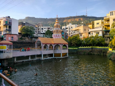
The primary objective behind the visit to Satara was to decode the city’s collage. This involved a comprehensive understanding of the systems and networks that drive its growth, while also exploring how intangible factors like culture, politics, and social dynamics shape its urban structure. The city of Satara was specifically chosen for its historical significance and the natural and architectural heritage that it has which could be compromised in the near future amidst the shifting growth dynamics of the city.
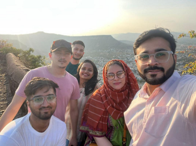
Day 01: Students exploring the city- Ajinkyatara Fort
Day 1:
During their site visit to Satara city, the group of urban design students embarked on a captivating exploration to understand the city’s unique identity. They carefully explored the city’s historical core, immersing themselves in its rich heritage and cultural significance. Diligently studying the city’s network, they analyzed the public transportation and road systems to observe how people moved around and connected with each other. The students meticulously mapped the city, focusing on its morphology, heritage, and infrastructural network, aiming to comprehend its structure, preserve its cultural legacy, and address its functional needs.
Day 01: Students exploring the city- Ajinkyatara Fort
Day 2:
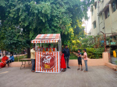
On the second day of their site visit to Satara city, the students engaged in a thorough and methodical analysis of the city, encompassing both its intangible and tangible aspects. Their exploration of the intangible aspect involved understanding people’s perceptions of the city and how they interacted with their urban environment. By observing the behavior of residents and visitors in public spaces, the students gained valuable insights into the city’s liveliness, functionality, and social dynamics. The perspective of people which helps to explores how individuals perceive and navigate the urban environment and focuses on creating meaningful and user-friendly spaces that foster a sense of community and identity. Furthermore, the students studied the distribution of land use in Satara, examining the mix of residential, commercial, industrial, and recreational areas. This analysis provided a comprehensive understanding of the city’s spatial organization and how it influenced daily life and economic activities and the future proposal.
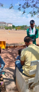
Day 02: Students interviewing the locals to understand their perceptions of the city
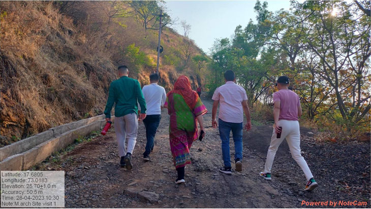
Day 3 & 4:
On days 3 and 4 of the site visit, the students delved deep into the process of finalizing their site interventions, fueled by the comprehensive analysis they had conducted earlier. Armed with a wealth of data, insights, and a thorough understanding of the city’s needs and potential, each student approached their individual projects with a particular lens that can benefit the city in the long- terms. Drawing upon the identification of needs and the thorough mapping and analysis of the city, the students meticulously designed their interventions. Each project was carefully tailored to cater to specific aspects of the city’s development, such as ecological preservation, historical heritage restoration, social and cultural enhancement, and economic growth. Additionally, they factored in the city’s future expansion plans, ensuring that their proposals were sustainable and adaptable to accommodate future urban growth and changes.
Day 03 & 04: Mapping the various activities in the city
Site Outcome:
- The mapping of the following points was conducted during the urban design study:
A. City heritage and Historic Core: Careful documentation and analysis of the city’s historical landmarks and cultural heritage to preserve its unique identity.
B. City’s changing morphology: Mapping the evolution of the city’s layout, land-use patterns, and urban form over time to understand its growth and development.
C. Infrastructure network: Thorough mapping of the city’s transportation systems, utilities, and essential services to identify areas for improvement and enhance urban functionality. - The analysis of the city was performed through various layers, encompassing both intangible and tangible parameters:
A. Intangible parameters: The study involved understanding people’s perceptions, observing the use of public spaces, analyzing the city’s image, and assessing the effectiveness of place-making initiatives.
B. Tangible parameters: Detailed analysis of connectivity, land use distribution, available services, amenities, and resources in the city to inform design proposals. - Specific intervention areas were finalized based on the city’s ecological, historical, socio-cultural, and economic needs, considering future expansion plans to create sustainable and well-balanced urban development proposals.
- Interviews and questionnaires were conducted to gain valuable insights from the residents:
- Interacting with people to understand their perspective and experiences of the city, including their likes and concerns.
- Observing and documenting the daily activities of residents to comprehend the patterns of use and preferences.
- Analyzing how people approached and utilized existing city facilities, identifying potential areas for improvement.
- Gathering feedback on their needs and desires, ensuring that urban interventions are in line with the aspirations and requirements of the local community.
Analysis of mapping and gathered data:
- Urban design theories, including Kevin Lynch’s “Image of the city,” were applied to analyze and understand the city’s design elements and how people perceive and navigate urban spaces.
- The theory of “place-making” was used to identify voids and opportunities within the city, extracting its essence and character to inform urban interventions.
- Emphasizing the concept of the “collage city,” the students recognized the city as a blend of various layers, integrating historic evidence with the contemporary context.
- By incorporating these urban design theories, the site analysis adopted a holistic approach, guiding the formulation of contextually relevant and thoughtful urban interventions that celebrate the city’s heritage while addressing its evolving needs and aspirations.